UN Adopts Equal Earth Map, Finally Showing Africa’s True Size
The United Nations General Assembly voted 164 to 1 on September 4, 2026, to adopt the Equal Earth map as its official world map, replacing the 450-year-old Mercator projection that has long made Africa look far smaller than it actually is. The United States cast the lone vote against the resolution, and six countries abstained. [...]
 Black News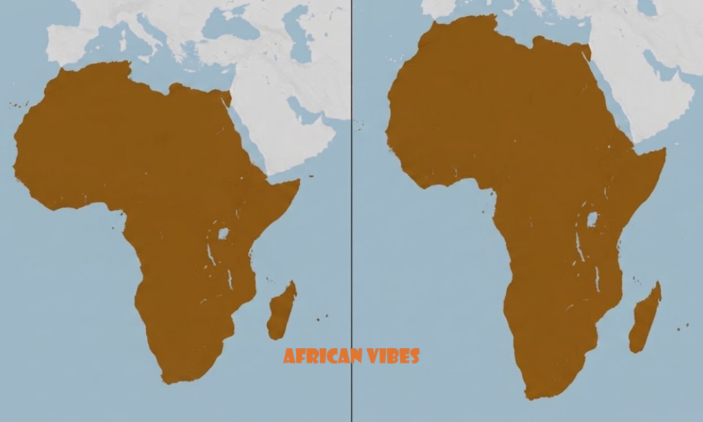

The United Nations General Assembly voted 164 to 1 on September 4, 2026, to adopt the Equal Earth map as its official world map, replacing the 450-year-old Mercator projection that has long made Africa look far smaller than it actually is. The United States cast the lone vote against the resolution, and six countries abstained.
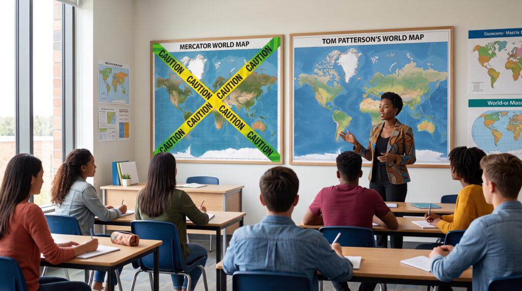
The measure, known as the “Correct the Map” resolution, was led by African Union member states alongside the Bahamas. It directs UN agencies to phase out the Mercator projection, developed by Flemish cartographer Gerardus Mercator in 1569, in favor of the Equal Earth map, which preserves the true relative size of land masses instead of inflating regions farther from the equator.
ALSO READ: African Union Adopts Resolution Declaring Slavery and Colonialism Genocide
What the Equal Earth Map Gets Right
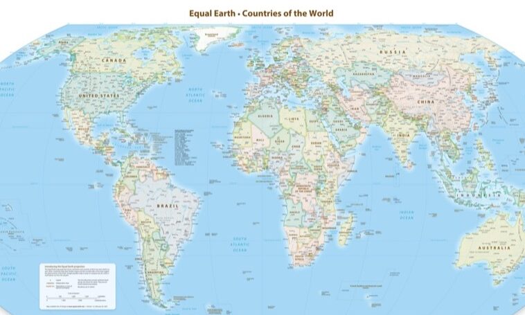
The Equal Earth map is an equal-area projection, meaning every landmass is shown at its true size relative to every other landmass. The Mercator projection is a conformal projection instead. It preserves angles and shapes for navigation, at the cost of massively inflating anything far from the equator.
The Mercator projection stretches land the closer it sits to the poles, so that Greenland, at roughly 2.16 million square kilometers, appears about the same size as Africa on most classroom and office wall maps. Africa actually covers about 30.3 million square kilometers, making it roughly 14 times larger than Greenland and large enough to contain the United States, China, India, and most of Europe combined, with room to spare.
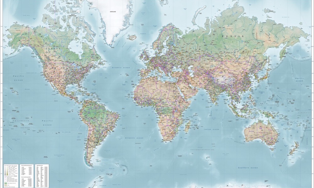
Placed side by side, the size gap becomes concrete. Here is how all seven continents compare, measured against Greenland, the landmass the Mercator map most famously inflates:
| Continent | Area (million km²) | Area (million sq mi) | Times Larger Than Greenland |
|---|---|---|---|
| Asia | 44.6 | 17.2 | 20.6× |
| Africa | 30.4 | 11.7 | 14.0× |
| North America | 24.7 | 9.5 | 11.4× |
| South America | 17.8 | 6.9 | 8.2× |
| Antarctica | 14.2 | 5.5 | 6.6× |
| Europe | 10.2 | 3.9 | 4.7× |
| Australia/Oceania | 8.5 | 3.3 | 3.9× |
Cartographer Tom Patterson, Bojan Šavrič, and Bernhard Jenny published the Equal Earth projection in 2018 specifically to correct this kind of distortion while keeping continents recognizable in shape, unlike some earlier equal-area alternatives. Under the new projection, Africa’s true scale becomes immediately visible next to North America, Europe, and Asia.
Why the Distortion Persisted
Mercator did not build his map with Africa’s size in mind. He drew it in 1569 to solve one navigational problem: helping sailors chart a straight compass course across open ocean. For that purpose, it worked, and European maritime powers, including England, the Netherlands, and Spain, adopted it for nautical charts within decades.
The distortion problem started later, when atlases, wall maps, and school textbooks began using that same navigational chart as an everyday picture of the world, without adjusting for its trade-offs. That shift happened alongside European colonial expansion into Africa, and by the 19th century, the Mercator map had become the default way Western publishers showed the globe.
Geographer Mark Monmonier of Syracuse University, author of the widely cited 1991 book “How to Lie with Maps,” has called the Mercator projection “obsolete” for general use and said geographers have long advised against using it as a world map at all. J.B. Harley, a historian whose work reshaped how scholars study cartography, argued that maps “are never value-free images” and always carry the assumptions of the people who choose them, an argument frequently applied to a map that made colonial powers look large and Africa look small at the exact moment those powers were carving up the continent.
That carving was not metaphorical. The 1884 to 1885 Berlin Conference saw European powers divide African territory into colonies on paper, often along straight lines that ignored existing ethnic and political boundaries. That episode is a separate, well-documented instance of mapmaking used as a tool of colonial administration, and it fell within the same decades that cemented the Mercator map’s grip on how the world pictured Africa.
Wilma Nchito, a geography professor at the University of Zambia who has taught cartography for three decades, has traced how that grip got passed down in the classroom rather than corrected. “Our education is colonial,” she told TRT Afrika. “The books I read in training for cartography are not written by us.
We learn as cartographers and teach that a projection does not reflect the real size.” She described the effect on students as starting early: “You start Grade 1 and you are told you are small and useless. This is what has happened to our continent.” Nchito is now writing a secondary school textbook that addresses the distortion directly.
Not the First Attempt to Fix It
The UN vote is not the first challenge to the Mercator map’s dominance. German historian Arno Peters popularized an alternative equal-area projection in 1973, arguing that Mercator’s version encoded a Eurocentric worldview. The Peters map gained some traction with aid organizations and UNESCO but was criticized for stretching continents into unfamiliar, elongated shapes.
Boston Public Schools switched its classroom maps from Mercator to the Gall-Peters projection in 2017, drawing national attention in the US to just how differently the two projections rendered Africa and South America. That switch applied to one school district. The September 2026 UN resolution applies to an intergovernmental body whose cartographic conventions ripple outward to textbook publishers and news organizations worldwide.
The Case Behind the Resolution
African Union Commission Deputy Chairperson Selma Malika Haddadi said the map matters beyond geography lessons. “It might seem to be just a map, but in reality, it is not,” she said, arguing that the Mercator projection has fostered a false impression that Africa is “marginal” in global affairs, media, and policy.
Togo’s Foreign Minister, Robert Dussey, who introduced the resolution on behalf of the African Group, put it more directly: “A fair map does not change the geography of the world, it changes how we see the world.” He added that maps “guide education, nourish the imagination, and influence collective perceptions.” French Foreign Minister Jean-Noel Barrot, whose country backed the resolution, noted that under Mercator, “the United States, Russia and China take on a disproportionate visual prominence” while Greenland appears almost as large as Africa.
The resolution passed with broad international backing: 164 countries in favor, six abstentions, and a single no vote from the United States.
Washington’s Objection
The US delegation was the resolution’s only opponent. Yaryna Ferencevych, deputy US representative to the UN Economic and Social Council, said after the vote that the UN was pushing an “ideological agenda” and diverting attention from more pressing priorities. The statement did not dispute the size discrepancy between the two projections, focusing instead on the resolution’s framing and timing.
The six abstaining countries were not named in the resolution’s public record as of publication.
What Changes Next
The resolution directs UN bodies to adopt the Equal Earth map as their standard reference going forward, a shift likely to influence textbook publishers, media outlets, and international organizations that have historically followed UN cartographic conventions.
It does not compel individual governments, schools, or private companies to make the switch, so Mercator-based maps will likely remain in circulation for years even as UN materials transition.
For the African Union states that pushed the resolution, the vote marks a rare case of a decades-old, largely uncontested visual convention being formally revisited at the UN’s highest deliberative body, placing a map projection alongside the kind of sovereignty and representation fights the bloc has raised in other forums.